by Gretchen N Peterson
Published by PetersonGIS on March 25th 2016
Style: single page illustrations
Pages: 94
Format: Soft cover

Goodreads
A selection of city maps from around the world for therapeutic coloring purposes.
This post contains affiliate links you can use to purchase the product. If you buy a book using that link, I will receive a small commission. This does not affect the price that you pay. Your support is very much appreciated x
City Maps Coloring Book Review
Well here’s something that you may not know about me. I’m “into” plans. I am one of those people that likes unrolling blueprints and seeing where the pipes go, what services are available, how a property looks in relation to surrounding properties and what the topography is like. Admittedly, this was a part of my job for a long period of time so it was necessary, but it was also fun as well. So when I seen City Maps coloring book it looked like it was right up my coloring alley.
Cover & Layout
City Maps is smaller in person that what I expected from the online photo. I seriously do not know when I will ever learn not to go off the picture but actually measure up before I buy! I’m often surprised when all sorts of coloring books land at my door and I think they are so much smaller than I expected. I am not saying that City Maps being small is a bad thing …I just thought it would be bigger which is my bad 🙁 I’m also used to dealing with large scale maps, plans, blueprints and drawings so everything looks small in comparison.

These simple squares can be very therapeutic to color in. No rules!
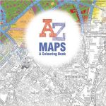
City Maps measures in at 21. 5 cm x 21.5 cm approximately (8.5 in x 8.5 in). It has a lovely glossy cover with a partially colored map on the front cover. On the back cover there are 4 smaller prints of maps that are inside.

A plain title page with a copyright page on the reverse is at the start of the book. A table of contents follows. The table of contents sets out where the maps originated from and includes page numbers. The book comprises over 40 maps for various locations. The range includes Beijing, Boston, Buenos Aires, Cairo, Dhaka, Istanbul, Karachi, London, Los Angeles, Manila, Mexico City, Moscow, Mumbai, New Delhi, New York City, Paris, Rio de Janeiro, Sao Paulo, Shanghai, Sydney, Tokyo, Venice and Vancouver. Most of the cities have 2 maps included in the book to represent their area.

The page numbers are odd numbers ie the drawings commence at page 1, with the next drawing page 3. It appears that the reverse of the image has not been numbered with the sequential number.
The maps have all been printed on white trade stock paper with one map per page.
Illustrations
The illustrations are really reprints of maps by the author who is a cartographer and has used data from the Open Street Map contributors, as listed in the book. There are no fairies or mermaids lurking in these maps 🙂
Each map has a thin border around it to frame it.
The fun thing with maps, is depending on the area and the services, density of living and the like the more interesting the map is to look at. For colorists though, this may be a challenge as some of the maps have very small details. You may need to have the sharpener on hand constantly. Other maps have larger areas of space to fill.

For new colorists, maps are wonderful to color. You can color in solid colors and all the colors you choose will look great. The other wonderful thing about maps is that you do not need to know what the lines represent. You do not need to scratch your head wondering if something is a leaf or a foot as it is all just shapes and lines.
The line art varies between maps and includes some fine lines, medium lines and some heavy lines. Some maps have very clear, crisp black line art and others are a duller black. This is to be expected in a book of maps with different countries of origin.
All of the maps have been nicely centered on the page and framed in a border. There is an ample allowance around the map to allow it to be put on a clipboard and to avoid coloring near the spine of the book.

If you need a change or challenge in coloring this may be a good book to try. Thinking about how to color a plan and make it look great can be a lot of fun. Inspiration can also be found in other similar style of books like Fantastic Cities.
As maps are not as common in the coloring world as other things like mermaids for instance, it would have been good to have pre colored images for inspiration on the rear cover of the book.
City Maps Coloring Book Video Review
Gretchen Peterson initially released the City Maps Coloring Book below which I reviewed. Enjoy the video flip through review of City Maps – A Coloring Book for Adults
New: City Maps Coloring Book (Revised Edition) Video Review
Enjoy the video review of the new City Maps Coloring Book which has been revised by Gretchen N Peterson below:
Where to buy City Maps Coloring Book
| Amazon US | Amazon UK | Amazon Canada | Book Depository |
Happy coloring x
Lea


Leave a Comment